


Voting Districts not defined, Ontonagon County, Michigan
About
Outline

Summary
| Unique Area Identifier | 599138 |
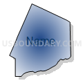
| Name | Voting Districts not defined |
| County | Ontonagon County |
| State | Michigan |
| Area (square miles) | 2,412.53 |
| Land Area (square miles) | 0.00 |
| Water Area (square miles) | 2,412.53 |
| % of Land Area | 0.00 |
| % of Water Area | 100.00 |
| Latitude of the Internal Point | 47.21660410 |
| Longtitude of the Internal Point | -89.50046140 |
Maps


Graphs
Select a template below for downloading or customizing gragh for Voting Districts not defined, Ontonagon County, Michigan


Neighbors
Neighoring Voting District (by Name) Neighboring Voting District on the Map
- Voting District 0538280000001, Gogebic County, MI
- Voting District 0617620000002, Houghton County, MI
- Voting District 1310001, Ontonagon County, MI
- Voting District 1310946000002, Ontonagon County, MI
- Voting District 1311352000001, Ontonagon County, MI
- Voting District 1316088000001, Ontonagon County, MI
- Voting Districts not defined, Cook County, MN
- WATER Voting District, Ashland County, WI
- Voting Districts not defined, Houghton County, MI
- Voting Districts not defined, Keweenaw County, MI
- Voting Districts not defined, Gogebic County, MI
Top 10 Neighboring County Subdivision (by Population) Neighboring County Subdivision on the Map
- Ontonagon township, Ontonagon County, MI (2,579)
- Stanton township, Houghton County, MI (1,419)
- Carp Lake township, Ontonagon County, MI (722)
- Wakefield township, Gogebic County, MI (305)
- Bohemia township, Ontonagon County, MI (82)
- County subdivisions not defined, Ontonagon County, MI (0)
- County subdivisions not defined, Keweenaw County, MI (0)
- County subdivisions not defined, Houghton County, MI (0)
- County subdivisions not defined, Cook County, MN (0)
- County subdivisions not defined, Ashland County, WI (0)
Top 10 Neighboring Place (by Population) Neighboring Place on the Map
Top 10 Neighboring Elementary School District (by Population) Neighboring Elementary School District on the Map
Top 10 Neighboring Unified School District (by Population) Neighboring Unified School District on the Map
- Calumet Public Schools, MI (8,473)
- Ironwood Area Schools, MI (8,046)
- Hancock Public Schools, MI (6,831)
- Cook County Public Schools, MN (5,176)
- Wakefield-Marenisco School District, MI (3,883)
- Ontonagon Area Schools, MI (3,632)
- Adams Township School District, MI (2,883)
- White Pine School District, MI (722)
- School District Not Defined (Water), WI (0)
Top 10 Neighboring State Legislative District Lower Chamber (by Population) Neighboring State Legislative District Lower Chamber on the Map
- State House District 110, MI (83,484)
- Assembly District 74, WI (52,623)
- State House District 6A, MN (36,396)
Top 10 Neighboring State Legislative District Upper Chamber (by Population) Neighboring State Legislative District Upper Chamber on the Map
- State Senate District 38, MI (261,728)
- State Senate District 25, WI (162,546)
- State Senate District 6, MN (76,702)
Top 10 Neighboring 111th Congressional District (by Population) Neighboring 111th Congressional District on the Map
Top 10 Neighboring Census Tract (by Population) Neighboring Census Tract on the Map
- Census Tract 7, Houghton County, MI (3,224)
- Census Tract 9702, Ontonagon County, MI (2,812)
- Census Tract 9507, Gogebic County, MI (2,402)
- Census Tract 9703, Ontonagon County, MI (2,033)
- Census Tract 9701, Ontonagon County, MI (1,935)
- Census Tract 9900, Gogebic County, MI (0)
- Census Tract 9901, Ontonagon County, MI (0)
- Census Tract 9901, Houghton County, MI (0)
- Census Tract 9901, Keweenaw County, MI (0)
- Census Tract 9900, Cook County, MN (0)